TROPICAL CYCLONE ADVISORY: ABPW10 PGTW 230600 MSGID/GENADMIN/JOINT TYPHOON WRNCEN PEARL HARBOR HI// SUBJ/SIGNIFICANT TROPICAL WEATHER ADVISORY FOR THE WESTERN AND SOUTH PACIFIC OCEANS/230600Z-240600ZJUN2026// REF/A/MSG/JOINT TYPHOON WRNCEN PEARL HARBOR HI/230151ZJUN2026// REF/B/MSG/JOINT TYPHOON WRNCEN PEARL HARBOR HI/230152ZJUN2026// NARR/REFS A AND B ARE TROPICAL CYCLONE WARNINGS.// RMKS/ 1. WESTERN NORTH PACIFIC AREA (180 TO MALAY PENINSULA): A. TROPICAL CYCLONE SUMMARY: (1) AT 23JUN26 0000Z, TROPICAL STORM 08W (HIGOS) WAS LOCATED NEAR 14.7N 145.6E, APPROXIMATELY 18 NM SOUTH OF TINIAN, AND HAD TRACKED WEST-NORTHWESTWARD AT 09 KNOTS OVER THE PAST SIX HOURS. MAXIMUM SUSTAINED SURFACE WINDS WERE ESTIMATED AT 35 KNOTS GUSTING TO 45 KNOTS. SEE REF B (WTPN32 PGTW 230300) FOR FURTHER DETAILS. (2) AT 23JUN26 0000Z, TYPHOON 07W (MEKKHALA) WAS LOCATED NEAR 18.9N 125.2E, APPROXIMATELY 478 NM SOUTH-SOUTHWEST OF KADENA AB, AND HAD TRACKED NORTH-NORTHWESTWARD AT 07 KNOTS OVER THE PAST SIX HOURS. MAXIMUM SUSTAINED SURFACE WINDS WERE ESTIMATED AT 115 KNOTS GUSTING TO 140 KNOTS. SEE REF A (WTPN31 PGTW 230300) FOR FURTHER DETAILS. (3) NO OTHER TROPICAL CYCLONES. B. TROPICAL DISTURBANCE SUMMARY: NONE. C. SUBTROPICAL SYSTEM SUMMARY: NONE. 2. SOUTH PACIFIC AREA (WEST COAST OF SOUTH AMERICA TO 135 EAST): A. TROPICAL CYCLONE SUMMARY: NONE. B. TROPICAL DISTURBANCE SUMMARY: NONE. C. SUBTROPICAL SYSTEM SUMMARY: NONE.// NNNN
THUNDERSTORM (c/o PAGASA)

Thunderstorm Advisory No. 11 #SLPRSD
Issued at 06:00 AM 24 June 2026

Moderate to occasionally heavy rainshowers with lightning and strong winds are being experienced in #Masbate(SanPascual), #Albay(Polangui, Libon, Oas), #CamarinesSur(Bula, Balatan, Bato, Nabua, Baao), #OrientalMindoro(Bongabong, Pinamalayan, Gloria, Bansud, Roxas, Bulalacao, Mansalay, Socorro, Pola), #Romblon(Concepcion, SanJose, SantaFe, Looc, Ferrol, Banton, Corcuera, Odiongan, Alcantara, SantaMaria, SanAndres, SanAgustin, Calatrava, Romblon), #Marinduque(Gasan, Buenavista, Torrijos and Boac) which may persist within 1 to 2 hours and may affect nearby areas.

Published by: SLPRSDValid until: Jun 24, 2026 08:00 AM
Affected Areas: Masbate, Albay, Camarines Sur, Oriental Mindoro, Romblon + 1 more
FLOOD

Under present weather conditions, At 3:00 AM today, the center of Typhoon "FRANCISCO" {MEKKHALA} was estimated based on all available data at 350 km East Northeast of Calayan, Cagayan or 275 km East of Basco, Batanes (20.3°N, 124.6°E) with maximum sustained winds of 155 km/h near the center and gustiness of up to 190 km/h. It is moving Northward at 10 km/h. Southwest Monsoon affecting Central Luzon, Southern Luzon, and Visayas.
The 12-hour rainfall forecast is Isolated light rains or thunderstorms.
WATERCOURSES NO LONGER TO BE AFFECTED :

+ **Lanao Del Norte** - Rivers and its tributaries particularly Mandulog, Agus, Liangan, Maranding, and Iligan.
+ **Misamis Occidental** - Rivers and its tributaries particularly Clarin, Palilan and Aloran.
+ **Misamis Oriental** - Rivers and its tributaries particularly Eastern Cagayan De Oro, Odiongan, Gingoog, Balatukan, Cabulig, Upper/Lower Tagoloan, Middle/Lower Western Cagayan De Oro, Iponan, and Alubijid.
+ **Camiguin** - All rivers and its tributaries
+ **Bukidnon** - Rivers and its tributaries particularly Upper Cagayan De Oro.

Published by: PAGASA-DOSTValid until: Jun 24, 2026 05:44 PM
Affected Areas: Lanao Del Norte, Misamis Occidental, Misamis Oriental, Camiguin, Bukidnon
FLOOD

Under present weather conditions, At 3:00 AM today, the center of Typhoon "FRANCISCO" {MEKKHALA} was estimated based on all available data at 350 km East Northeast of Calayan, Cagayan or 275 km East of Basco, Batanes (20.3°N, 124.6°E) with maximum sustained winds of 155 km/h near the center and gustiness of up to 190 km/h. It is moving Northward at 10 km/h. Southwest Monsoon affecting Central Luzon, Southern Luzon, and Visayas.
The 12-hour rainfall forecast is light to moderate rains and thunderstorms.
WATERCOURSES LIKELY TO BE AFFECTED :

+ **Capiz** - Rivers and its tributaries particularly Panay, Mambusao, Panay Malinao, Alingon and Balantian.
+ **Antique** - Rivers and its tributaries particularly Sibalom, Ipayo, Cagaranan, Palawan, Cairauan, Dalanas and Tibiao.
+ **Guimaras** - All rivers and its tributaries
+ **Iloilo** - Rivers and its tributaries particularly Pinantan, Barotac, Akalaygan, Jalaud, Jalano, Jagdong, Jalaur, Lamunan, Jaro-Aganan, Sibalom and Guimbal.
+ **Negros Occidental** - Rivers and its tributaries particularly Malogo, Sicaba, Grande, Himogaan, Danao, Upper Tabanan, Sipalay and Lower Ilog.
+ **Aklan** - Rivers and its tributaries particularly Ibajay, Aklan and Jalo.

Published by: PAGASA-DOSTValid until: Jun 24, 2026 05:29 PM
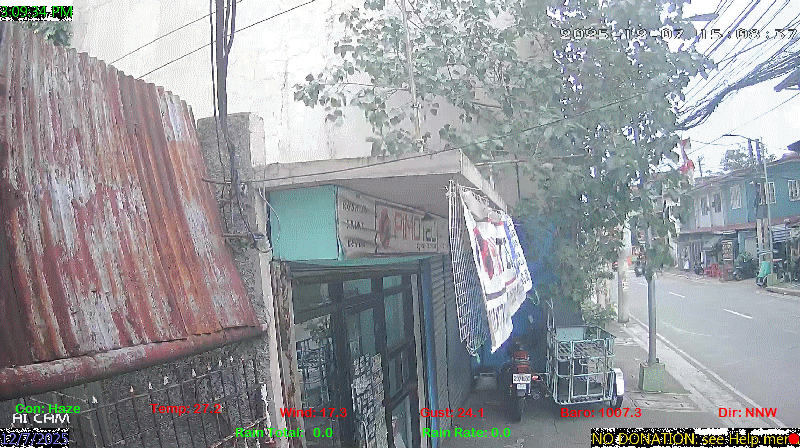
Affected Areas: Capiz, Antique, Guimaras, Iloilo, Negros Occidental + 1 more
spacer
METRIC | IMPERIAL
Updated: 06/24/2026 @ 6:00am  
Temperature Current Conditions Forecast / Storm Prediction
Outside Temperature: Warmer 0.8°C than last hour.

27.9°C

Heat Index:  33.9°C
Feels like:  34°C
Warm
Indoor Temperature

87.8°C

Max Humidex:  42.1°C
Indoor Humidity: %
High Today
29.6°C
12:01 AM
Low Today
26.7°C
4:26 AM
Yest High
34.0°C
1:05 PM
Yest Low
27.3°C
5:41 AM
Sta* High
37.0°C
4/28/2026
Sta* Low
0.0°C
5/5/2026
Space Weather Status
X-Ray: C1.7 Max: B8.9
NORMAL
Geomagnetic Field: 2.67
QUIET
Partly cloudy Partly cloudy ,
Partly cloudy

Wind from SSW Wind:  SSW
12.6

Gusting to:
16.2 km/h
Current Rain Rain Total:
4.8 mm
Rain Warning Rain Rate:
Chandler Burning Index: LOW Current CBI
Fire Danger:
-0.8 % of 100%
LA NINA / EL NINO
Wednesday
Rain, Partially cloudy rain
Rain, Partially cloudy with 31°C
27°C
Thursday
Overcast rain
Overcast with 31°C
27°C
Friday
Overcast rain
Overcast with 29°C
26°C
Official Record High
07W FRANCISCO TY 157 kph INSIDE PAR
08W HIGOS TD 56 kph OUTSIDE PAR
VOLCANO THERMAL ALERT STATUS
TAAL
Volcano Alert Status
MAYON
Volcano Alert Status
PINATUBO
Volcano Alert Status
Dew Point Liquid Precipitation Wind Speed Sun/Moon
Current: Increased 0.3°C since last hour. 26.7°C
Last Hour: Increased 0.3°C since last hour. 0.3°C
High 4:16 AM: 27.9°C
Low 4:27 AM: 25.8°C
Record High: 31.0°C on
May-26-2026
Record Low: 16.2°C on
Mar-14-2026
Wetbulb: 27.0°C


Today: 4.80 mm
Yesterday: 0.00 mm
Last 7 Days: 67.20 mm
Jun Rain: 265.20 mm
Jun to Date
  Avg:10
0.00 mm
Jun to Date
  Diff from Avg:10
Over 265.2 mm for the month 265.20 mm
Jun Avg: 296.10 mm
Diff from Avg: Under 30.9 mm for the month 30.90 mm
Season:1 431.7 mm
YTD
  Avg:11
366.30 mm
YTD
  Diff from Avg:11
Over 65.4 mm for the year 65.40 mm
Last Rain
Time/Date:
Jun-24-2026
at 4:32 AM
44 rain days in 2026
14 days in June
0 days since last rain
Current: SSW  12.6 km/h
Highest Speed: 20.4 km/h
1Hr Average: 5.9 km/h
Wind Run: 35.64 km
Wind Gust
Current: 16.2 km/h
Today: 72.7 km/h 4:16 AM
Month: 92.9 km/h Jun-1
Year: 116.9 km/h May-29
Record Gust: 116.9 km/h
May-29-2026
Sunlight:
12 hrs 59 min 39 sec
of Sunlight Today
Which is 3 sec Shorter
Than Yesterday


(Noon)
graph (Midnight)

Highslide JS
LAST QUARTER, 8 days, 19 hours, 14 minutes in cycle
50%
Illuminated
Outside Humidity Barometer
Current: Decreased 3% since last hour. 93%
Last Hour: Decreased 3% since last hour. 3%
High 4:40 AM: 98%
Low 3:04 AM: 88%
Record High: 99%
Dec-10-2025
Record Low: 0%
May-5-2026
Current: Rising 0.5  hPa/hr 1005.1 hPa
Last Hour: Rising slowly
High 12:01 AM: 1005.6
Low 2:44 AM: 1003.5
Record High: 1017.0 hPa
Jan-24-2026
Record Low: 1001.5 hPa
May-12-2026
Cooling Degree Days Tide Heat Index Air Quality
Today: 2.6
Jun: 262.0
2026 to Date: 1492.3
Heating Degree Days
2026 to Date: 0.0

3 minutes to high tide at
06:11 AM PST


Current: 33.9°C
High 12:01am: 39.2°C
Yesterday: 50.4°C
Record: 56.5°C
May-26-2026

24

Good

PM2.5: 5.7 ug/m3 PM10: 14.93 ug/m3

Last Updated: 2026-06-24 06:08:24 PHT
Current UV Index Current Solar Energy9
0.0
Sunburn in
720 Minutes
Highest:
12:01 AM
0.0
18 W/m2
2%
W/m2 SI
High Today:
5:59 AM
18  W/m2
Record:
1034 W/m2
Almanac Irrigation Index5 Station All Time Records Cloud Level
Currently: Morning
YTD Avg Temp: 28.3°C
Sunrise: 5:28 am
Sunset: 6:28 pm
Moonrise: 1:46 pm
Moonset: 1:31 am
Full Moon: 23:57 UTC June 29 2026
Next Eclipse:
Image
12 Aug 2026 (50 days away): Total solar eclipse Thu, 13 Aug 2026 01:47:00 AM PST
Updated at Midnight
Current ET: 0.40 mm
7-Days Rain: 67.20 mm
7-Days ET: 15.00 mm
7-Day:  52.2 mm water in excess of what evaporated in last 7 days. 52.2 mm
June:  221.7 mm water in excess of what evaporated this month. 221.7 mm
Solar HF Condition
HIGHS: LOWS:
37.0°C
Apr-28-2026
0.0°C
May-5-2026
Daytime Records
  34.2°C
May-03-2026
  23.4°C
Dec-20-2025
Nitetime Records
  31.6°C
Apr-05-2026
  23.4°C
Jan-02-2026
ICN:19 | S3C2:5 | Ajax 3.xx
ISS:Ok | CON:%vpconsolebattery% | RCP:%vpreception2%
METRIC | IMPERIAL
Updated: 06/24/2026 @ 6:00am  
1 Rain season in the Philippines: June 1st to Oct 31st.   5 Estimated amount of water needed to replace the water used by plants and evaporation from the past week. (Negative numbers mean amount of water needed, positive numbers mean excess water is present).   6 Air Quality Index is provided by Luftdaten System esp8266 and is updated every 5 mins..   9 Solar Index represents either an absolute scale of solar energy (W/m²) using the station’s recorded maximum or a percentage of computed theoretical solar maximum using the station’s location and time of day. These indices differ most when the sun is low on the horizon. The current scale is shown, and will toggle if it or the icon is clicked.   10 Historical average only to day 24 of just the month of June for this station since 2016.   11 Historical average rain this season to day 24 of June for this station since 2016.
 VC Weather Forecast  -   with local Weather Outlook for Wednesday & Thursday
Wednesday
Rain, Partially cloudy rain
Rain, Partially cloudy
31°C
27°C
VC forecast: Partly cloudy throughout the day with storms possible. Chance of precipitation (rain) 65%. High: 31°C. Low: 27°C. Wind WSW 18->27 km/h. UV Index 6.
Local Weather Advisory:

Easterlies affecting Southern Luzon, Visayas, and the eastern section of Mindanao.
Thursday
Overcast rain
Overcast
31°C
27°C
VC forecast: Cloudy skies throughout the day. Chance of precipitation (rain) 26%. High: 31°C. Low: 27°C. Wind SW 23->26 km/h. UV Index 9.
 VC Short Term Weather Forecast
Friday
Overcast rain
Overcast
Saturday
Overcast rain
Overcast
Sunday
Overcast rain
Overcast
Monday
Rain, Overcast rain
Rain, Overcast
Tuesday
Rain, Overcast rain
Rain, Overcast
Wednesday
Rain, Partially cloudy rain
Rain, Partially cloudy
Thursday
Rain, Partially cloudy rain
Rain, Partially cloudy
29°C
26°C
30°C
26°C
31°C
26°C
33°C
25°C
33°C
26°C
33°C
26°C
32°C
26°C
Version 6.95 - 05-Jan-2016 - Script Mods by: BurnsvilleWeatherLIVE.com