2026-07-02 17:35 PM WATCH: Geomagnetic Storm Category G2 Predicted Highest Storm Level Predicted by Day: Jul 02: None (Below G1) Jul 03: G2 (Moderate) Jul 04: G2 (Moderate) THIS SUPERSEDES ANY/ALL PRIOR WATCHES IN EFFECT Comment: Potential Impacts: Area of impact primarily poleward of 55 degrees Geomagnetic Latitude. Induced Currents - Power grid fluctuations can occur. High-latitude power systems may experience voltage alarms. Spacecraft - Satellite orientation irregularities may occur; increased drag on low Earth-orbit satellites is possible. Radio - HF (high frequency) radio propagation can fade at higher latitudes. Aurora - Aurora may be seen as low as New York to Wisconsin to Washington state. TROPICAL CYCLONE ADVISORY: ABPW10 PGTW 020600 MSGID/GENADMIN/JOINT TYPHOON WRNCEN PEARL HARBOR HI// SUBJ/SIGNIFICANT TROPICAL WEATHER ADVISORY FOR THE WESTERN AND SOUTH PACIFIC OCEANS/020600Z-030600ZJUL2026// REF/A/MSG/JOINT TYPHOON WRNCEN PEARL HARBOR HI/020151ZJUL2026// REF/B/MSG/JOINT TYPHOON WRNCEN PEARL HARBOR HI/020152ZJUL2026// NARR/REFS A AND B ARE TROPICAL CYCLONE WARNINGS.// RMKS/ 1. WESTERN NORTH PACIFIC AREA (180 TO MALAY PENINSULA): A. TROPICAL CYCLONE SUMMARY: (1) AT 02JUL26 0000Z, TROPICAL STORM 09W (BAVI) WAS LOCATED NEAR 10.9N 160.2E, APPROXIMATELY 912 NM EAST OF ANDERSEN AFB, AND HAD TRACKED WEST-NORTHWESTWARD AT 13 KNOTS OVER THE PAST SIX HOURS. MAXIMUM SUSTAINED SURFACE WINDS WERE ESTIMATED AT 50 KNOTS GUSTING TO 65 KNOTS. SEE REF A (WTPN31 PGTW 020300) FOR FURTHER DETAILS. (2) AT 02JUL26 0000Z, TROPICAL DEPRESSION 10W (TEN) WAS LOCATED NEAR 17.6N 113.1E, APPROXIMATELY 289 NM SOUTH-SOUTHWEST OF HONG KONG, AND HAD TRACKED WESTWARD AT 18 KNOTS OVER THE PAST SIX HOURS. MAXIMUM SUSTAINED SURFACE WINDS WERE ESTIMATED AT 30 KNOTS GUSTING TO 40 KNOTS. SEE REF B (WTPN32 PGTW 020300) FOR FURTHER DETAILS. (3) NO OTHER TROPICAL CYCLONES. B. TROPICAL DISTURBANCE SUMMARY: NONE. C. SUBTROPICAL SYSTEM SUMMARY: NONE. 2. SOUTH PACIFIC AREA (WEST COAST OF SOUTH AMERICA TO 135 EAST): A. TROPICAL CYCLONE SUMMARY: NONE. B. TROPICAL DISTURBANCE SUMMARY: NONE. C. SUBTROPICAL SYSTEM SUMMARY: NONE.// NNNN
THUNDERSTORM (c/o PAGASA)

Thunderstorm Advisory No. 9 #MINPRSD
Issued at 07:29 PM 02 July 2026

Moderate to occasionally heavy rainshowers with lightning and strong winds are expected over #Bukidnon(Baungon, Libona, Talakag), #LanaoDelNorte(Baloi, Linamon, Matungao), #LanaoDelSur(Saguiaran, Bubong, DitsaanRamain), #MisamisOriental(Medina, Talisayan, Balingoan, Kinoguitan, Sugbongcogon, Binuangan, Salay, Lagonglong, Balingasag, Jasaan and Villanueva) within the next 1-2 hours.

The above conditions are being experienced in #AgusanDelNorte(ButuanCity, Buenavista, Magallanes, Nasipit, Carmen, LasNieves), #MisamisOriental(Magsaysay, GingoogCity, Claveria, Opol, CityOfElSalvador, CagayanDeOroCity, Alubijid, Manticao, Naawan, Lugait, Laguindingan, Gitagum, Libertad, Initao, Tagoloan), #AgusanDelSur(Sibagat, Prosperidad, CityOfBayugan, Esperanza), #LanaoDelNorte(IliganCity, Tagoloan, Pantar), #Bukidnon(ManoloFortich, Malitbog, ImpasugOng, Sumilao), #NorthCotabato(Kabacan, CityOfKidapawan, Matalam, PresidentRoxas, Antipas), #LanaoDelSur(TagoloanII, MarawiCity and Kapai) which may persist within 1-2 hours and may affect nearby areas.

Published by: MINPRSDValid until: Jul 02, 2026 09:29 PM
Affected Areas: Agusan del Norte, Misamis Oriental, Agusan del Sur, Lanao del Norte, Bukidnon + 2 more
THUNDERSTORM

Thunderstorm Advisory No. 20 #NCR_PRSD
Issued at: 7:25 PM, 02 July 2026(Thursday)

Moderate to heavy rainshowers with lightning and strong winds are expected over Bataan(Morong, Bagac, Mariveles) and Tarlac(Mayantoc, San Jose, San Clemente, Camiling, Santa Ignacia) within the next 2 hours.

The above conditions are being experienced in Quezon(Burdeos, Polillo, Patnanungan, Jomalig) and Zambales(Santa Cruz, Candelaria) which may persist within 2 hours and may affect nearby areas.

Published by: NCRPRSDValid until: Jul 02, 2026 09:25 PM
Affected Areas: Quezon, Zambales, Bataan, Tarlac
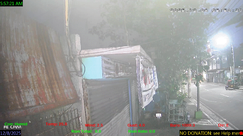
spacer
METRIC | IMPERIAL
Updated: 07/02/2026 @ 7:30pm  
Temperature Current Conditions Forecast / Storm Prediction
Outside Temperature: Colder 1°C than last hour.

29.1°C

Heat Index:  36.7°C
Feels like:  37°C
Warm
Indoor Temperature

92.9°C

Max Humidex:  43.4°C
Indoor Humidity: %
High Today
35.6°C
1:28 PM
Low Today
28.0°C
4:55 AM
Yest High
35.1°C
12:39 PM
Yest Low
26.3°C
5:04 AM
Sta* High
37.0°C
4/28/2026
Sta* Low
0.0°C
6/27/2026
Space Weather Status
X-Ray: C3.2 Max: M2.8
M CLASS
Geomagnetic Field: 1
QUIET
Mostly cloudy Mostly cloudy ,
Mostly cloudy

Wind from NNE Wind:  NNE
4.0

Gusting to:
7.9 km/h
Current Rain Rain Total:
0.0 mm
Rain Warning Rain Rate:
Chandler Burning Index: LOW Current CBI
Fire Danger:
0.1 % of 100%
LA NINA / EL NINO
Thursday
Rain, Partially cloudy rain
Rain, Partially cloudy with 35°C
27°C
Friday
Rain, Overcast rain
Rain, Overcast with 32°C
25°C
Saturday
Rain, Partially cloudy rain
Rain, Partially cloudy with 32°C
26°C
VOLCANO THERMAL ALERT STATUS
TAAL
Volcano Alert Status
MAYON
Volcano Alert Status
PINATUBO
Volcano Alert Status
Dew Point Liquid Precipitation Wind Speed Sun/Moon
Current: Increased 0.2°C since last hour. 26.7°C
Last Hour: Increased 0.2°C since last hour. 0.2°C
High 3:15 PM: 29.2°C
Low 4:00 PM: 25.3°C
Record High: 31.0°C on
May-26-2026
Record Low: 0.0°C on
Jun-27-2026
Wetbulb: 27.4°C


Today: 0.00 mm
Yesterday: 0.00 mm
Last 7 Days: 76.20 mm
Jul Rain: 0.00 mm
Jul to Date
  Avg:10
0.00 mm
Jul to Date
  Diff from Avg:10
No Change 0.00 mm
Jul Avg: 1021.40 mm
Diff from Avg: Under 1021.4 mm for the month 1021.40 mm
Season:1 519.3 mm
YTD
  Avg:11
671.80 mm
YTD
  Diff from Avg:11
Under 152.5 mm for the year 152.50 mm
Last Rain
Time/Date:
Jun-30-2026
at 9:07 PM
50 rain days in 2026
0 days in July
1 day since last rain
Current: NNE  4.0 km/h
Highest Speed: 25.9 km/h
1Hr Average: 2.8 km/h
Wind Run: 67.40 km
Wind Gust
Current: 7.9 km/h
Today: 52.5 km/h 3:25 PM
Month: 76.8 km/h Jul-1
Year: 116.9 km/h May-29
Record Gust: 116.9 km/h
May-29-2026
Sunlight:
12 hrs 58 min 42 sec
of Sunlight Today
Which is 11 sec Shorter
Than Yesterday


(Noon)
graph (Midnight)

Highslide JS
LAST QUARTER, 17 days, 8 hours, 47 minutes in cycle
50%
Illuminated
Outside Humidity Barometer
Current: Increased 6% since last hour. 87%
Last Hour: Increased 6% since last hour. 6%
High 4:58 AM: 89%
Low 1:39 PM: 66%
Record High: 99%
Dec-10-2025
Record Low: 0%
May-5-2026
Current: Rising 1.4  hPa/hr 1008.8 hPa
Last Hour: Rising
High 7:28 PM: 1009.1
Low 2:52 PM: 1006.2
Record High: 1017.0 hPa
Jan-24-2026
Record Low: 941.0 hPa
Jun-27-2026
Cooling Degree Days Tide Heat Index Air Quality
Today: 9.0
Jul: 20.0
2026 to Date: 1581.5
Heating Degree Days
2026 to Date: 0.0

6 minutes to low tide at
07:47 PM PST


Current: 36.7°C
High 1:28pm: 51.4°C
Yesterday: 50.2°C
Record: 56.5°C
May-26-2026

53

Moderate

PM2.5: 13.07 ug/m3 PM10: 20.85 ug/m3

Last Updated: 2026-07-02 19:41:44 PHT
UV Summary/Forecast Solar Summary
High Today:   14.0 @ 11:36 AM
Jul-03

Jul-04

Jul-05

High Today:  
958 W/m2 @ 11:38 AM
Sun Hours Today:
01:56
   This Month: 03:57 Hrs
Rise: 5:31 am  Set: 6:29 pm
Almanac Irrigation Index5 Station All Time Records Cloud Level
Currently: Evening
YTD Avg Temp: 28.4°C
Sunrise: 5:31 am
Sunset: 6:29 pm
Moonrise: 8:17 pm
Moonset: 7:56 am
Full Moon: 23:57 UTC June 29 2026
Next Eclipse:
Image
12 Aug 2026 (42 days away): Total solar eclipse Thu, 13 Aug 2026 01:47:00 AM PST
Updated at Midnight
Current ET: 2.70 mm
7-Days Rain: 76.20 mm
7-Days ET: 33.90 mm
7-Day:  42.3 mm water in excess of what evaporated in last 7 days. 42.3 mm
July:  81 mm water in deficit of what evaporated this month. 81 mm
Solar HF Condition
HIGHS: LOWS:
37.0°C
Apr-28-2026
0.0°C
Jun-27-2026
Daytime Records
  34.2°C
May-03-2026
  23.4°C
Dec-20-2025
Nitetime Records
  31.6°C
Apr-05-2026
  23.4°C
Jan-02-2026
ICN:4 | S3C2:5 | Ajax 3.xx
ISS:Ok | CON:%vpconsolebattery% | RCP:%vpreception2%
METRIC | IMPERIAL
Updated: 07/02/2026 @ 7:30pm  
1 Rain season in the Philippines: June 1st to Oct 31st.   5 Estimated amount of water needed to replace the water used by plants and evaporation from the past week. (Negative numbers mean amount of water needed, positive numbers mean excess water is present).   6 Air Quality Index is provided by Luftdaten System esp8266 and is updated every 5 mins..   10 Historical average only to day 2 of just the month of July for this station since 2016.   11 Historical average rain this season to day 2 of July for this station since 2016.
 VC Weather Forecast  -   with local Weather Outlook for Thursday & Friday
Thursday
Rain, Partially cloudy rain
Rain, Partially cloudy
35°C
27°C
VC forecast: Partly cloudy throughout the day with storms possible. Chance of precipitation (rain) 100%. High: 35°C. Low: 27°C. Wind ESE 15->17 km/h. UV Index 7.
Local Weather Advisory:
Issued: 4:00 PM, 02 July 2026 Southwest Monsoon affecting the western section of Southern Luzon.
Friday
Rain, Overcast rain
Rain, Overcast
32°C
25°C
VC forecast: Cloudy skies throughout the day with storms possible. Chance of precipitation (rain) 71%. High: 32°C. Low: 25°C. Wind SSE 8->16 km/h. UV Index 9.
 VC Short Term Weather Forecast
Saturday
Rain, Partially cloudy rain
Rain, Partially cloudy
Sunday
Rain, Partially cloudy rain
Rain, Partially cloudy
Monday
Partially cloudy rain
Partially cloudy
Tuesday
Rain, Partially cloudy rain
Rain, Partially cloudy
Wednesday
Rain, Overcast rain
Rain, Overcast
Thursday
Rain, Overcast rain
Rain, Overcast
Friday
Rain, Overcast rain
Rain, Overcast
32°C
26°C
33°C
26°C
32°C
26°C
31°C
26°C
29°C
26°C
27°C
26°C
26°C
26°C
Version 6.95 - 05-Jan-2016 - Script Mods by: BurnsvilleWeatherLIVE.com