2026-07-02 07:20 AM SUMMARY: X-ray Event exceeded M5 Begin Time: 2026 Jul 01 2257 UTC Maximum Time: 2026 Jul 01 2309 UTC End Time: 2026 Jul 02 2313 UTC Xray Class: M8.5 Optical Class: 2b Location: S07W25 Noaa Scale: R2 - Moderate Comment: NOAA Scale: R2 - Moderate Potential Impacts: Area of impact centered primarily on sub-solar point on the sunlit side of Earth. Radio - Limited blackout of HF (high frequency) radio communication for tens of minutes. TROPICAL CYCLONE ADVISORY: ABPW10 PGTW 012100 MSGID/GENADMIN/JOINT TYPHOON WRNCEN PEARL HARBOR HI// SUBJ/SIGNIFICANT TROPICAL WEATHER ADVISORY FOR THE WESTERN AND SOUTH PACIFIC OCEANS REISSUED/012100Z-020600ZJUL2026// REF/A/MSG/JOINT TYPHOON WRNCEN PEARL HARBOR HI/011951ZJUL2026// REF/B/MSG/JOINT TYPHOON WRNCEN PEARL HARBOR HI/011952ZJUL2026// NARR/REFS A AND B ARE TROPICAL CYCLONE WARNINGS.// RMKS/ 1. WESTERN NORTH PACIFIC AREA (180 TO MALAY PENINSULA): A. TROPICAL CYCLONE SUMMARY: (1) AT 01JUL26 1800Z, TROPICAL STORM 09W (NINE) WAS LOCATED NEAR 10.5N 161.4E, APPROXIMATELY 987 NM EAST OF ANDERSEN AFB, AND HAD TRACKED NORTHWESTWARD AT 13 KNOTS OVER THE PAST SIX HOURS. MAXIMUM SUSTAINED SURFACE WINDS WERE ESTIMATED AT 40 KNOTS GUSTING TO 50 KNOTS. SEE REF A (WTPN31 PGTW 012100) FOR FURTHER DETAILS. (2) AT 01JUL26 1800Z, TROPICAL DEPRESSION 10W (TEN) WAS LOCATED NEAR 17.3N 115.0E, APPROXIMATELY 303 NM SOUTH OF HONG KONG, AND HAD TRACKED WEST-NORTHWESTWARD AT 15 KNOTS OVER THE PAST SIX HOURS. MAXIMUM SUSTAINED SURFACE WINDS WERE ESTIMATED AT 25 KNOTS GUSTING TO 35 KNOTS. SEE REF B (WTPN32 PGTW 012100) FOR FURTHER DETAILS. (3) NO OTHER TROPICAL CYCLONES. B. TROPICAL DISTURBANCE SUMMARY: (1) THE AREA OF CONVECTION (INVEST 96W) PREVIOUSLY LOCATED NEAR 13.8N 121.2E IS NOW THE SUBJECT OF A TROPICAL CYCLONE WARNING. SEE PARA. 1.A.(2) FOR FURTHER DETAILS. (2) NO OTHER SUSPECT AREAS. C. SUBTROPICAL SYSTEM SUMMARY: NONE. 2. SOUTH PACIFIC AREA (WEST COAST OF SOUTH AMERICA TO 135 EAST): A. TROPICAL CYCLONE SUMMARY: NONE. B. TROPICAL DISTURBANCE SUMMARY: NONE. C. SUBTROPICAL SYSTEM SUMMARY: NONE.// 3. JUSTIFICATION FOR REISSUE: JUSTIFICATION FOR REISSUE: UPGRADED AREA IN PARA 1.B.(1) TO WARNING STATUS.// NNNN
THUNDERSTORM (c/o PAGASA)

Thunderstorm Advisory No. 1 #NLPRSD
Issued at 12:20 PM 02 July 2026

Moderate to occasionally Heavy rainshowers with lightning and strong winds are expected over #Cagayan(Solana, Iguig, Enrile, Amulung, Baggao), #MountainProvince(Natonin), #Ifugao(AlfonsoLista, Banaue), #IlocosNorte(NuevaEra, Sarrat, Dingras, SanNicolas, LaoagCity, Solsona, Piddig, Carasi, Bacarra) and #IlocosSur(Sinait) within the next 1 to 2 hours.

The above conditions are being experienced in #Cagayan(TuguegaraoCity, Peñablanca), #MountainProvince(Barlig), #Ifugao(Aguinaldo, Mayoyao), #IlocosNorte(CityOfBatac, Currimao, Badoc, Pinili, Paoay, Banna and Marcos) which may persist within 30 mins to 1 hour and may affect nearby areas.

All are advised to take precautionary measures against the impacts associated with these hazards. Residents along mountain slope are advised for possible landslides mudslides, rockslides and flash flood.

Published by: NLPRSDValid until: Jul 02, 2026 02:20 PM
Affected Areas: Cagayan, Mountain Province, Ifugao, Ilocos Norte, Ilocos Sur
THUNDERSTORM

Thunderstorm Advisory No. 14 #NCR_PRSD
Issued at: 12:07 PM, 02 July 2026(Thursday)

Moderate to heavy rainshowers with lightning and strong winds are expected over Nueva Ecija(Pantabangan, San Jose, Llanera, Munoz, Talavera, Santo Domingo, Aliaga, Cabanatuan, General Mamerto Natividad, Rizal, Bongabon, Palayan, Laur, Gabaldon) and Rizal(Rodriguez, Antipolo, Tanay, Baras, San Mateo, Teresa, Angono, Morong) within the next 2 hours.

The above conditions are being experienced in Quezon(Lopez, General Luna, Macalelon, Gumaca, Tagkawayan) which may persist within 2 hours and may affect nearby areas.

Published by: NCRPRSDValid until: Jul 02, 2026 02:07 PM
Affected Areas: Quezon, Nueva Ecija, Rizal
THUNDERSTORM

Thunderstorm Advisory No. 5 #MINPRSD
Issued at 12:00 PM 02 July 2026

Moderate to occasionally heavy rainshowers with lightning and strong winds are expected over #TawiTawi(SapaSapa, PanglimaSugala, Tandubas, Languyan, TurtleIslands, Mapun, SouthUbian), #DavaoOriental(GovernorGeneroso, SanIsidro, CityOfMati, Banaybanay, Lupon, Cateel, Boston), #DavaoDeOro(Pantukan, Monkayo, Montevista, Nabunturan, Mawab, Maco, Mabini), #ZamboangaDelNorte(Gutalac, Siocon, Siayan, JoseDalman, Manukan, Katipunan, Pres.ManuelA.Roxas, Salug, Godod, LeonB.Postigo, Liloy, Labason, Kalawit, Tampilisan, SergioOsmeñaSr.), #DavaoDelNorte(NewCorella), #Bukidnon(ImpasugOng, ManoloFortich, Baungon, Libona, Lantapan, CityOfMalaybalay, Malitbog, CityOfValencia, Maramag), #MisamisOriental(GingoogCity, Lagonglong, Balingasag, Sugbongcogon, Balingoan, Kinoguitan, Talisayan, Medina), #ZamboangaDelSur(Mahayag, Josefina, Tambulig, Molave, Tigbao, Lakewood, PagadianCity, Midsalip, Dumingag, RamonMagsaysay, Sominot, Labangan), #MisamisOccidental(DonVictorianoChiongbian), #SurigaoDelNorte(SurigaoCity, SanFrancisco, Sison, TaganaAn, Placer, Malimono, Bacuag, Tubod, Alegria, Gigaquit, Mainit, Claver), #LanaoDelSur(Kapatagan, Balabagan, Marogong, Malabang, Wao, Picong, LumbacaUnayan, Calanogas, SultanDumalondong, Tubaran, Butig, Lumbatan, Lumbayanague, Bayang, Pagayawan, Binidayan, Ganassi, Masiu, Pualas, PoonaBayabao, Tamparan, Taraka, Madamba, BacolodKalawi, Mulondo, Tugaya, Balindong, Madalum, BuadiposoBuntong, Marantao, DitsaanRamain, Bubong, Piagapo, MarawiCity, Saguiaran, Kapai, TagoloanII), #AgusanDelNorte(Magallanes, RemediosT.Romualdez, CityOfCabadbaran, Santiago, Tubay, Jabonga, Kitcharao), #LanaoDelNorte(Nunungan), #SouthCotabato(T'Boli, Tampakan), #SultanKudarat(Columbio, Lebak, Kalamansig), #DavaoDelSur(Matanao, Kiblawan, Magsaysay), #MaguindanaoDelSur(SouthUpi), #MaguindanaoDelNorte(Upi, DatuBlahT.Sinsuat), #Sulu(HadjiPanglimaTahil, Jolo, Indanan, Parang, Maimbung, Patikul, Talipao), #ZamboangaSibugay(Titay), #Sarangani(Malapatan, Glan, Alabel), #DavaoOccidental(DonMarcelino, JoseAbadSantos) and #DinagatIslands within the next 1-2 hours.

The above conditions are being experienced in #TawiTawi(Sitangkai, Sibutu, Simunul, Bongao), #Sulu(Pangutaran, Pandami, Lugus, Siasi, Tapul), #DavaoOriental(Tarragona, Manay, Caraga, Baganga), #DavaoDeOro(NewBataan, Maragusan, Compostela), #ZamboangaDelNorte(Baliguian, Sindangan), #Bukidnon(Sumilao, Talakag, Kalilangan, Pangantucan), #MisamisOriental(Binuangan, Salay, Claveria), #LanaoDelSur(LumbaBayabao, Bumbaran and Maguing) which may persist within 1-2 hours and may affect nearby areas.

Published by: MINPRSDValid until: Jul 02, 2026 02:00 PM
Affected Areas: Tawi-Tawi, Sulu, Davao Oriental, Davao de Oro, Davao de Oro + 28 more
THUNDERSTORM

Thunderstorm Advisory No. 11 #VISPRSD
Issued at 12:00 PM 02 July 2026

Moderate to Heavy rainshowers with lightning and strong winds are expected over #NegrosOriental(BaisCity, CityOfBayawan, Amlan, SanJose, DumagueteCity, Bacong, Dauin, Zamboanguita), #Bohol(Carmen, Calape, Loay, Lila), #Samar(Daram, Zumarraga and Pinabacdao) within the next 30 minutes to an hour.

The above conditions are being experienced in #NegrosOriental(Siaton, SantaCatalina, Valencia, Sibulan, Pamplona, CityOfTanjay, Ayungon), #Bohol(Balilihan, Sevilla, Sikatuna, Bilar, SanIsidro, Catigbian, Batuan, Loboc), #Samar(Talalora, Villareal and SantaRita) which may persist within 1 to 2 hours and may affect nearby areas.

Published by: VISPRSDValid until: Jul 02, 2026 02:00 PM
Affected Areas: Negros Oriental, Bohol, Samar
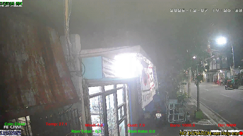
spacer
METRIC | IMPERIAL
Updated: 07/02/2026 @ 12:30pm  
Temperature Current Conditions Forecast / Storm Prediction
Outside Temperature: Colder 0.3°C than last hour.

33.5°C

Heat Index:  45.6°C
Feels like:  46°C
Hot
Indoor Temperature

101.1°C

Max Humidex:  48.5°C
Indoor Humidity: %
High Today
34.9°C
11:47 AM
Low Today
28.0°C
4:55 AM
Yest High
35.1°C
12:39 PM
Yest Low
26.3°C
5:04 AM
Sta* High
37.0°C
4/28/2026
Sta* Low
0.0°C
6/27/2026
Space Weather Status
X-Ray: C3.8 Max: C8.6
NORMAL
Geomagnetic Field: 2
QUIET
Partly cloudy Partly cloudy ,
Partly cloudy

Wind from N Wind:  N
5.4

Gusting to:
12.2 km/h
Current Rain Rain Total:
0.0 mm
Rain Warning Rain Rate:
Chandler Burning Index: LOW Current CBI
Fire Danger:
5.5 % of 100%
LA NINA / EL NINO
Thursday
Rain, Partially cloudy rain
Rain, Partially cloudy with 33°C
27°C
Friday
Rain, Overcast rain
Rain, Overcast with 34°C
26°C
Saturday
Rain, Partially cloudy rain
Rain, Partially cloudy with 33°C
26°C
VOLCANO THERMAL ALERT STATUS
TAAL
Volcano Alert Status
MAYON
Volcano Alert Status
PINATUBO
Volcano Alert Status
Dew Point Liquid Precipitation Wind Speed Sun/Moon
Current: Decreased 0.5°C since last hour. 27.3°C
Last Hour: Decreased 0.5°C since last hour. 0.5°C
High 11:51 AM: 29.0°C
Low 3:28 AM: 25.7°C
Record High: 31.0°C on
May-26-2026
Record Low: 0.0°C on
Jun-27-2026
Wetbulb: 28.9°C


Today: 0.00 mm
Yesterday: 0.00 mm
Last 7 Days: 76.20 mm
Jul Rain: 0.00 mm
Jul to Date
  Avg:10
0.00 mm
Jul to Date
  Diff from Avg:10
No Change 0.00 mm
Jul Avg: 1021.40 mm
Diff from Avg: Under 1021.4 mm for the month 1021.40 mm
Season:1 519.3 mm
YTD
  Avg:11
671.80 mm
YTD
  Diff from Avg:11
Under 152.5 mm for the year 152.50 mm
Last Rain
Time/Date:
Jun-30-2026
at 9:07 PM
50 rain days in 2026
0 days in July
1 day since last rain
Current: N  5.4 km/h
Highest Speed: 13.1 km/h
1Hr Average: 8.2 km/h
Wind Run: 30.43 km
Wind Gust
Current: 12.2 km/h
Today: 37.0 km/h 11:54 AM
Month: 76.8 km/h Jul-1
Year: 116.9 km/h May-29
Record Gust: 116.9 km/h
May-29-2026
Sunlight:
12 hrs 58 min 42 sec
of Sunlight Today
Which is 11 sec Shorter
Than Yesterday


(Noon)
graph (Midnight)

Highslide JS
LAST QUARTER, 17 days, 1 hours, 40 minutes in cycle
50%
Illuminated
Outside Humidity Barometer
Current: Decreased 1% since last hour. 70%
Last Hour: Decreased 1% since last hour. 1%
High 4:58 AM: 89%
Low 12:05 PM: 69%
Record High: 99%
Dec-10-2025
Record Low: 0%
May-5-2026
Current: Falling 0.2  hPa/hr 1007.5 hPa
Last Hour: Steady
High 8:30 AM: 1008.7
Low 3:04 AM: 1006.4
Record High: 1017.0 hPa
Jan-24-2026
Record Low: 941.0 hPa
Jun-27-2026
Cooling Degree Days Tide Heat Index Air Quality
Today: 5.4
Jul: 16.4
2026 to Date: 1577.9
Heating Degree Days
2026 to Date: 0.0

7 hours, 13 minutes to low tide at
07:47 PM PST


Current: 45.6°C
High 11:42am: 50.7°C
Yesterday: 50.2°C
Record: 56.5°C
May-26-2026

11

Good

PM2.5: 2.7 ug/m3 PM10: 4.7 ug/m3

Last Updated: 2026-07-02 12:34:43 PHT
Current UV Index Current Solar Energy9
4.0
Sunburn in
28 Minutes
Highest:
11:36 AM
14.0
331 W/m2
0%
W/m2 SI
High Today:
11:38 AM
958  W/m2
Record:
1456 W/m2
Almanac Irrigation Index5 Station All Time Records Cloud Level
Currently: Afternoon
YTD Avg Temp: 28.4°C
Sunrise: 5:31 am
Sunset: 6:29 pm
Moonrise: 8:17 pm
Moonset: 7:56 am
Full Moon: 23:57 UTC June 29 2026
Next Eclipse:
Image
12 Aug 2026 (42 days away): Total solar eclipse Thu, 13 Aug 2026 01:47:00 AM PST
Updated at Midnight
Current ET: 2.60 mm
7-Days Rain: 76.20 mm
7-Days ET: 33.90 mm
7-Day:  42.3 mm water in excess of what evaporated in last 7 days. 42.3 mm
July:  81 mm water in deficit of what evaporated this month. 81 mm
Solar HF Condition
HIGHS: LOWS:
37.0°C
Apr-28-2026
0.0°C
Jun-27-2026
Daytime Records
  34.2°C
May-03-2026
  23.4°C
Dec-20-2025
Nitetime Records
  31.6°C
Apr-05-2026
  23.4°C
Jan-02-2026
ICN:19 | S3C2:5 | Ajax 3.xx
ISS:Ok | CON:%vpconsolebattery% | RCP:%vpreception2%
METRIC | IMPERIAL
Updated: 07/02/2026 @ 12:30pm  
1 Rain season in the Philippines: June 1st to Oct 31st.   5 Estimated amount of water needed to replace the water used by plants and evaporation from the past week. (Negative numbers mean amount of water needed, positive numbers mean excess water is present).   6 Air Quality Index is provided by Luftdaten System esp8266 and is updated every 5 mins..   9 Solar Index represents either an absolute scale of solar energy (W/m²) using the station’s recorded maximum or a percentage of computed theoretical solar maximum using the station’s location and time of day. These indices differ most when the sun is low on the horizon. The current scale is shown, and will toggle if it or the icon is clicked.   10 Historical average only to day 2 of just the month of July for this station since 2016.   11 Historical average rain this season to day 2 of July for this station since 2016.
 VC Weather Forecast  -   with local Weather Outlook for Thursday & Friday
Thursday
Rain, Partially cloudy rain
Rain, Partially cloudy
33°C
27°C
VC forecast: Partly cloudy throughout the day with rain. Chance of precipitation (rain) 97%. High: 33°C. Low: 27°C. Wind SSE 16->19 km/h. UV Index 7.
Local Weather Advisory:
Issued: 4:00 AM, 02 July 2026 Southwest Monsoon affecting the western sections of Southern Luzon, Visayas, and Mindanao. "Tropical Cyclone Present"
TROPICAL CYCLONE OUTSIDE PAR AS OF 3:00 AM TODAY TROPICAL DEPRESSION (FORMERLY "HENRY") LOCATION: 610 KM WEST OF BACNOTAN, LA UNION (17.2°N, 114.7°E) MAXIMUM SUSTAINED WINDS: 55 KM/H NEAR THE CENTER GUSTINESS: UP TO 70 KM/H MOVEMENT: WEST NORTHWESTWARD AT 25 KM/H

Friday
Rain, Overcast rain
Rain, Overcast
34°C
26°C
VC forecast: Cloudy skies throughout the day with storms possible. Chance of precipitation (rain) 68%. High: 34°C. Low: 26°C. Wind SE 13->20 km/h. UV Index 9.
 VC Short Term Weather Forecast
Saturday
Rain, Partially cloudy rain
Rain, Partially cloudy
Sunday
Rain rain
Rain
Monday
Rain, Partially cloudy rain
Rain, Partially cloudy
Tuesday
Rain, Partially cloudy rain
Rain, Partially cloudy
Wednesday
Rain, Overcast rain
Rain, Overcast
Thursday
Rain, Overcast rain
Rain, Overcast
Friday
Rain, Overcast rain
Rain, Overcast
33°C
26°C
33°C
26°C
32°C
26°C
30°C
26°C
29°C
25°C
28°C
26°C
26°C
26°C
Version 6.95 - 05-Jan-2016 - Script Mods by: BurnsvilleWeatherLIVE.com