2026-06-28 18:41 PM WATCH: Geomagnetic Storm Category G1 Predicted Highest Storm Level Predicted by Day: Jun 28: None (Below G1) Jun 29: G1 (Minor) Jun 30: G1 (Minor) THIS SUPERSEDES ANY/ALL PRIOR WATCHES IN EFFECT Comment: Potential Impacts: Area of impact primarily poleward of 60 degrees Geomagnetic Latitude. Induced Currents - Weak power grid fluctuations can occur. Spacecraft - Minor impact on satellite operations possible. Aurora - Aurora may be visible at high latitudes, i.e., northern tier of the U.S. such as northern Michigan and Maine. TROPICAL CYCLONE ADVISORY: ABPW10 PGTW 280600 MSGID/GENADMIN/JOINT TYPHOON WRNCEN PEARL HARBOR HI// SUBJ/SIGNIFICANT TROPICAL WEATHER ADVISORY FOR THE WESTERN AND SOUTH PACIFIC OCEANS/280600Z-290600ZJUN2026// REF/A/MSG/JOINT TYPHOON WRNCEN PEARL HARBOR HI/271351ZJUN2026// AMPN/REF A IS A TROPICAL CYCLONE FINAL WARNING.// RMKS/ 1. WESTERN NORTH PACIFIC AREA (180 TO MALAY PENINSULA): A. TROPICAL CYCLONE SUMMARY: (1) AT 27JUN26 1200Z, TROPICAL STORM 07W (MEKKHALA) WAS LOCATED NEAR 35.5N 141.4E, APPROXIMATELY 84 NM EAST OF YOKOSUKA, JAPAN, AND HAD TRACKED EAST-NORTHEASTWARD AT 47 KNOTS OVER THE PAST SIX HOURS. MAXIMUM SUSTAINED SURFACE WINDS WERE ESTIMATED AT 40 KNOTS GUSTING TO 50 KNOTS. SEE REF A (WTPN31 PGTW 271500) FOR THE FINAL WARNING ON THIS SYSTEM. (2) NO OTHER TROPICAL CYCLONES. B. TROPICAL DISTURBANCE SUMMARY: (1) THE AREA OF CONVECTION (INVEST 95W) PREVIOUSLY LOCATED NEAR 5.3N 168.3E IS NOW LOCATED NEAR 6.4N 165.6E, APPROXIMATELY 183 NM SOUTHWEST OF KWAJALEIN. ANIMATED MULTISPECTRAL SATELLITE IMAGERY (MSI) REVEALS A BROAD LOW-LEVEL CIRCULATION WITH DISORGANIZED FLARING CONVECTION. THE STRONGEST WINDS CONTINUE TO BE CONFINED TO THE SOUTHEASTERN QUADRANT OF THE SYSTEM, ASSOCIATED WITH THE WESTERLY WIND BURST. ENVIRONMENTAL ANALYSIS REVEALS FAVORABLE CONDITIONS FOR DEVELOPMENT WITH LOW VERTICAL WIND SHEAR (LESS THAN 15 KNOTS), GOOD POLEWARD OUTFLOW ALOFT, AND WARM (29-30 C) SEA SURFACE TEMPERATURES. GLOBAL MODELS ARE IN GOOD AGREEMENT ON THE STEADY DEVELOPMENT OF A BROAD CIRCULATION WITH SLOW MOVEMENT OVER THE NEXT 24-48 HOURS. MAXIMUM SUSTAINED SURFACE WINDS ARE ESTIMATED AT 20 TO 25 KNOTS. MINIMUM SEA LEVEL PRESSURE IS ESTIMATED TO BE NEAR 1006 MB. THE POTENTIAL FOR THE DEVELOPMENT OF A SIGNIFICANT TROPICAL CYCLONE WITHIN THE NEXT 24 HOURS REMAINS MEDIUM. (2) NO OTHER SUSPECT AREAS. C. SUBTROPICAL SYSTEM SUMMARY: NONE. 2. SOUTH PACIFIC AREA (WEST COAST OF SOUTH AMERICA TO 135 EAST): A. TROPICAL CYCLONE SUMMARY: NONE. B. TROPICAL DISTURBANCE SUMMARY: NONE. C. SUBTROPICAL SYSTEM SUMMARY: NONE.// NNNN
THUNDERSTORM (c/o PAGASA)

Thunderstorm Advisory No. 14 #VISPRSD
Issued at 08:07 PM 28 June 2026

Moderate to Heavy rainshowers with lightning and strong winds are expected over #NegrosOccidental(Candoni, HinobaAn), #Palawan(Culion and ElNido) within the next 30 minutes to an hour.

The above conditions are being experienced in #NegrosOccidental(Ilog, CityOfKabankalan, Cauayan, CityOfSipalay, CityOfHimamaylan, Binalbagan, Hinigaran, Pontevedra, SanEnrique, Valladolid), #Palawan(SanVicente and Linapacan) which may persist within 1 to 2 hours and may affect nearby areas.

Published by: VISPRSDValid until: Jun 28, 2026 10:07 PM
Affected Areas: Negros Occidental, Palawan
THUNDERSTORM

Thunderstorm Advisory No. 5 #MINPRSD
Issued at 08:00 PM 28 June 2026

Moderate to occasionally heavy rainshowers with lightning and strong winds are expected over #ZamboangaCity, #ZamboangaDelNorte(Sibuco), #DavaoCity, #NorthCotabato(CityOfKidapawan, Magpet, PresidentRoxas, Antipas, Matalam, Kabacan, Arakan), #SultanKudarat(Lambayong, Esperanza, Isulan, Columbio, Bagumbayan, Lebak, Kalamansig, Sen.NinoyAquino), #SouthCotabato(Norala, CityOfKoronadal, Banga, SantoNiño), #MaguindanaoDelSur(Gen.S.K.Pendatun, Paglat, Pandag, DatuPaglas, DatuAbdullahSangki, Ampatuan, SouthUpi, ShariffAguak, DatuUnsay, DatuHofferAmpatuan, Guindulungan, Talayan) and #DavaoDelNorte(CityOfSamal) within the next 1-2 hours.

The above conditions are being experienced in #SultanKudarat(CityOfTacurong, Lutayan, PresidentQuirino), #SouthCotabato(Tantangan), #MaguindanaoDelSur(Mangudadatu and Buluan) which may persist within 1-2 hours and may affect nearby areas.

Published by: MINPRSDValid until: Jun 28, 2026 10:00 PM
Affected Areas: Zamboanga City, Zamboanga del Norte, Davao City, North Cotabato, Sultan Kudarat + 16 more
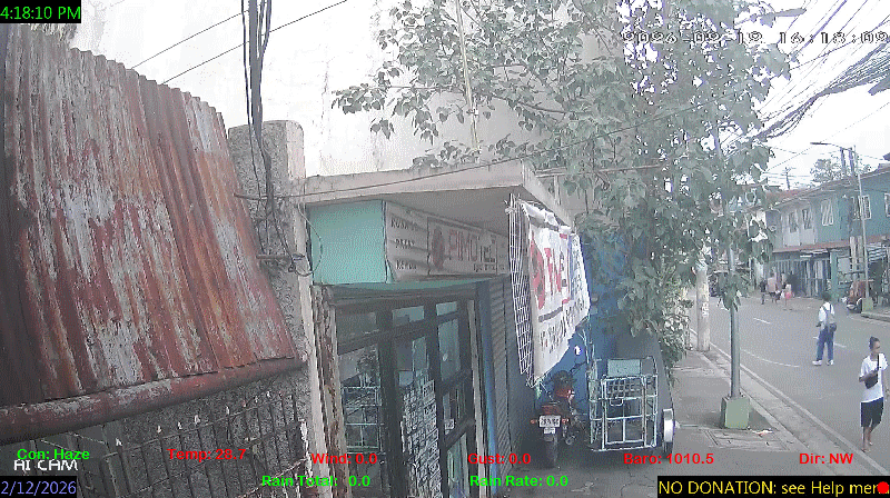
spacer
METRIC | IMPERIAL
Updated: 06/28/2026 @ 8:30pm  
Temperature Current Conditions Forecast / Storm Prediction
Outside Temperature: Colder 0.3°C than last hour.

29.4°C

Heat Index:  37.4°C
Feels like:  37°C
Warm
Indoor Temperature

87.8°C

Max Humidex:  43.8°C
Indoor Humidity: %
High Today
33.7°C
1:51 PM
Low Today
25.7°C
6:26 AM
Yest High
32.6°C
3:00 PM
Yest Low
24.4°C
10:05 AM
Sta* High
37.0°C
4/28/2026
Sta* Low
0.0°C
6/27/2026
Space Weather Status
X-Ray: C2.1 Max: C2.2
NORMAL
Geomagnetic Field: 1.33
QUIET
Few Clouds Few Clouds ,
Few Clouds

Wind from SE Wind:  SE
21.6

Gusting to:
28.1 km/h
Current Rain Rain Total:
1.5 mm
Rain Warning Rain Rate:
Chandler Burning Index: LOW Current CBI
Fire Danger:
0.3 % of 100%
LA NINA / EL NINO
Sunday
Rain, Partially cloudy rain
Rain, Partially cloudy with 32°C
28°C
Monday
Rain, Partially cloudy rain
Rain, Partially cloudy with 33°C
26°C
Tuesday
Rain, Partially cloudy rain
Rain, Partially cloudy with 31°C
25°C
VOLCANO THERMAL ALERT STATUS
TAAL
Volcano Alert Status
MAYON
Volcano Alert Status
PINATUBO
Volcano Alert Status
Dew Point Liquid Precipitation Wind Speed Sun/Moon
Current: Increased 0.3°C since last hour. 26.8°C
Last Hour: Increased 0.3°C since last hour. 0.3°C
High 8:39 AM: 27.7°C
Low 6:25 AM: 24.9°C
Record High: 31.0°C on
May-26-2026
Record Low: 0.0°C on
Jun-27-2026
Wetbulb: 27.5°C


Today: 1.50 mm
Yesterday: 14.70 mm
Last 7 Days: 83.70 mm
Jun Rain: 297.90 mm
Jun to Date
  Avg:10
0.00 mm
Jun to Date
  Diff from Avg:10
Over 297.9 mm for the month 297.90 mm
Jun Avg: 296.10 mm
Diff from Avg: Over 1.8 mm for the month 1.80 mm
Season:1 464.4 mm
YTD
  Avg:11
366.30 mm
YTD
  Diff from Avg:11
Over 98.1 mm for the year 98.10 mm
Last Rain
Time/Date:
Jun-28-2026
at 8:38 AM
48 rain days in 2026
18 days in June
0 days since last rain
Current: SE  21.6 km/h
Highest Speed: 40.7 km/h
1Hr Average: 20.4 km/h
Wind Run: 196.93 km
Wind Gust
Current: 28.1 km/h
Today: 85.1 km/h 8:46 AM
Month: 100.8 km/h Jun-25
Year: 116.9 km/h May-29
Record Gust: 116.9 km/h
May-29-2026
Sunlight:
12 hrs 59 min 19 sec
of Sunlight Today
Which is 7 sec Shorter
Than Yesterday


(Noon)
graph (Midnight)

Highslide JS
LAST QUARTER, 13 days, 9 hours, 40 minutes in cycle
50%
Illuminated
Outside Humidity Barometer
Current: Increased 3% since last hour. 86%
Last Hour: Increased 3% since last hour. 3%
High 6:31 AM: 97%
Low 2:40 PM: 67%
Record High: 99%
Dec-10-2025
Record Low: 0%
May-5-2026
Current: Rising 0.7  hPa/hr 1007.2 hPa
Last Hour: Rising slowly
High 8:58 AM: 1008.2
Low 3:00 PM: 1004.7
Record High: 1017.0 hPa
Jan-24-2026
Record Low: 1001.5 hPa
May-12-2026
Cooling Degree Days Tide Heat Index Air Quality
Today: 8.8
Jun: 309.1
2026 to Date: 1539.4
Heating Degree Days
2026 to Date: 0.0

11 hours, 25 minutes to falling: tide at
08:00 AM PST


Current: 37.4°C
High 1:52pm: 45.3°C
Yesterday: 44.9°C
Record: 56.5°C
May-26-2026

17

Good

PM2.5: 4.07 ug/m3 PM10: 8.25 ug/m3

Last Updated: 2026-06-28 20:35:00 PHT
UV Summary/Forecast Solar Summary
High Today:   15.0 @ 9:20 AM
Jun-29

12.3
Jun-30

12.1
Jul-01

12.3
High Today:  
1001 W/m2 @ 9:20 AM
Sun Hours Today:
02:00
   This Month: 49:18 Hrs
Rise: 5:29 am  Set: 6:28 pm
Almanac Irrigation Index5 Station All Time Records Cloud Level
Currently: Evening
YTD Avg Temp: 28.3°C
Sunrise: 5:29 am
Sunset: 6:28 pm
Moonrise: 5:09 pm
Moonset: 4:28 am
Full Moon: 23:57 UTC June 29 2026
Next Eclipse:
Image
12 Aug 2026 (46 days away): Total solar eclipse Thu, 13 Aug 2026 01:47:00 AM PST
Updated at Midnight
Current ET: 10.90 mm
7-Days Rain: 83.70 mm
7-Days ET: 28.10 mm
7-Day:  55.6 mm water in excess of what evaporated in last 7 days. 55.6 mm
June:  232.7 mm water in excess of what evaporated this month. 232.7 mm
Solar HF Condition
HIGHS: LOWS:
37.0°C
Apr-28-2026
21.4°C
Jan-24-2026
Daytime Records
  34.2°C
May-03-2026
  23.4°C
Dec-20-2025
Nitetime Records
  31.6°C
Apr-05-2026
  23.4°C
Jan-02-2026
ICN:4 | S3C2:5 | Ajax 3.xx
ISS:Ok | CON:%vpconsolebattery% | RCP:%vpreception2%
METRIC | IMPERIAL
Updated: 06/28/2026 @ 8:30pm  
1 Rain season in the Philippines: June 1st to Oct 31st.   5 Estimated amount of water needed to replace the water used by plants and evaporation from the past week. (Negative numbers mean amount of water needed, positive numbers mean excess water is present).   6 Air Quality Index is provided by Luftdaten System esp8266 and is updated every 5 mins..   10 Historical average only to day 28 of just the month of June for this station since 2016.   11 Historical average rain this season to day 28 of June for this station since 2016.
 VC Weather Forecast  -   with local Weather Outlook for Sunday & Monday
Sunday
Rain, Partially cloudy rain
Rain, Partially cloudy
32°C
28°C
VC forecast: Partly cloudy throughout the day with storms possible. Chance of precipitation (rain) 100%. High: 32°C. Low: 28°C. Wind W 29->32 km/h. UV Index 6.
Local Weather Advisory:
At 3:00 PM today, the Low Pressure Area (LPA) was estimated based on all available data at 705 km East of Surigao City, Surigao del Norte (10.3°N, 131.9°E). Southwest Monsoon affecting the western section of Luzon.
Monday
Rain, Partially cloudy rain
Rain, Partially cloudy
33°C
26°C
VC forecast: Partly cloudy throughout the day with storms possible. Chance of precipitation (rain) 87%. High: 33°C. Low: 26°C. Wind SSW 14->19 km/h. UV Index 10.
 VC Short Term Weather Forecast
Tuesday
Rain, Partially cloudy rain
Rain, Partially cloudy
Wednesday
Rain, Overcast rain
Rain, Overcast
Thursday
Rain, Partially cloudy rain
Rain, Partially cloudy
Friday
Rain, Partially cloudy rain
Rain, Partially cloudy
Saturday
Rain, Partially cloudy rain
Rain, Partially cloudy
Sunday
Rain, Partially cloudy rain
Rain, Partially cloudy
Monday
Rain, Overcast rain
Rain, Overcast
31°C
25°C
31°C
25°C
31°C
25°C
32°C
26°C
33°C
26°C
34°C
26°C
32°C
26°C
Version 6.95 - 05-Jan-2016 - Script Mods by: BurnsvilleWeatherLIVE.com