Thunderstorm Watch #VISPRSD
Issued at 10:00 AM 24 June 2026
Thunderstorm is MORE LIKELY to develop over #Cebu, #Bohol, #Siquijor, #NegrosOriental, #NegrosOccidental, #Iloilo, #Guimaras, #Antique, #Capiz, #Aklan, #Leyte, #SouthernLeyte, #Biliran, #EasternSamar, #Samar, #Palawan and #OccidentalMindoro within 12 hours.
Published by: VISPRSDValid until: Jun 24, 2026 10:00 PM
Thunderstorm Watch #MINPRSD
Issued at 10:00 AM 24 June 2026
Thunderstorm is MORE LIKELY to develop over #DavaoCity, #DavaoDelNorte, #DavaoDelSur, #DavaoOriental, #DavaoOccidental and #DavaoDeOro within 12 hours.
Published by: MINPRSDValid until: Jun 24, 2026 10:00 PM
Affected Areas: Davao City, Davao del Norte, Davao del Sur, Davao Oriental, Davao Occidental + 1 more
Light to moderate with occasional heavy rains affecting Bataan, Zambales(Castillejos, Subic, Botolan, San Marcelino, Cabangan, San Antonio, San Felipe, San Narciso, Olongapo), Cavite(Maragondon, Magallanes, Ternate, General Emilio Aguinaldo) and Batangas(Nasugbu) and may affect nearby areas.
The public and the Disaster Risk Reduction and Management Offices concerned are advised to MONITOR the weather condition and watch for the next warning to be issued at 11:00 AM today.
For more information and queries, please call telephone numbers 8927-1335 and 8927-2877 or log on to www.pagasa.dost.gov.ph.
Published by: NCRPRSDValid until: Jun 24, 2026 11:37 AM
Affected Areas: Zambales, Zambales, Zambales, Zambales, Zambales + 73 more
Light to moderate rains affecting Bataan, Zambales(Olongapo, Subic, Botolan, San Marcelino, Cabangan, Castillejos, San Antonio, San Felipe, San Narciso), Batangas(Nasugbu) and Cavite(Maragondon, Ternate, Magallanes, General Emilio Aguinaldo) and may affect nearby areas.
The public and the Disaster Risk Reduction and Management Offices concerned are advised to MONITOR the weather condition and watch for the next warning to be issued at 11:00 AM today.
For more information and queries, please call telephone numbers 8927-1335 and 8927-2877 or log on to www.pagasa.dost.gov.ph.
Published by: NCRPRSDValid until: Jun 24, 2026 11:34 AM
Affected Areas: Zambales, Zambales, Zambales, Zambales, Zambales + 73 more
Moderate to heavy rainshowers with lightning and strong winds are expected over Quezon(Lucban, Sampaloc, Tayabas, Mauban, Real, General Nakar, Infanta) within the next 2 hours.
Intense to torrential rainshowers with lightning and strong winds are being experienced in Bulacan(San Jose del Monte, Norzagaray, Obando, Meycauayan, Marilao, Santa Maria), Rizal(Rodriguez, San Mateo, Cardona, Binangonan, Pililla, Tanay, Jala-Jala), Metro Manila(Valenzuela, Caloocan, Quezon City, Malabon, Navotas, Marikina) and Laguna(Calamba, Santa Maria, Mabitac, Pangil, Siniloan, Famy, Pakil) which may persist within 2 hours and may affect nearby areas.
Published by: NCRPRSDValid until: Jun 24, 2026 11:33 AM
Affected Areas: Bulacan, Rizal, Metro Manila, Laguna, Quezon
THUNDERSTORM
Thunderstorm Advisory No. 11 #MINPRSD
Issued at 09:30 AM 24 June 2026
Light to Moderate to Occasionally Heavy rainshowers with lightning and strong winds are expected over #Sulu(OldPanamao, KalingalanCaluang, Luuk, Pata) and #DavaoOccidental(Sarangani) within the next 1-2 hours.
The above conditions are being experienced in #ZamboangaDelSur(Pitogo, VincenzoA.Sagun, Margosatubig, Dimataling, Tabina), #ZamboangaSibugay(Mabuhay, Talusan, Olutanga, Payao, Alicia, Malangas, Imelda), #Sulu(Banguingui, Omar), #ZamboangaCity and #Basilan which may persist within 1-2 hours and may affect nearby areas.
Published by: MINPRSDValid until: Jun 24, 2026 11:30 AM
Affected Areas: Zamboanga del Sur, Zamboanga Sibugay, Sulu, Zamboanga City, Basilan + 1 more
THUNDERSTORM
Thunderstorm Advisory No. 9 #VISPRSD
Issued at 09:22 AM 24 June 2026
Moderate to Heavy rainshowers with lightning and strong winds are expected over #Samar(Tarangnan, Pagsanghan, SanJorge and SantaMargarita) within the next 30 minutes to an hour.
The above conditions are being experienced in #Samar(Gandara and Matuguinao) which may persist within 1 to 2 hours and may affect nearby areas.
Published by: VISPRSDValid until: Jun 24, 2026 11:22 AM
Affected Areas: Samar
METRIC |
IMPERIAL
Updated:
06/24/2026 @ 10:00am
Temperature
Current Conditions
Forecast / Storm Prediction
Outside Temperature:
26.4°C
Feels like:
30°C Warm
Indoor Temperature
80.8°C
Indoor Humidity: %
High Today 29.6°C
12:01 AM
Low Today 26.4°C
9:59 AM
Yest High 34.0°C
1:05 PM
Yest Low 27.3°C
5:41 AM
Sta* High 37.0°C 4/28/2026
Sta* Low 0.0°C 5/5/2026
Space Weather Status
X-Ray: B9.5 Max: C3.5 Geomagnetic Field: 1
Overcast ,
Overcast
Wind:
SSW
22.7 Gusting to: 28.1 km/h
Rain Total:
5.1 mm
Rain Rate:
Current CBI Fire Danger: -1.0 % of 100%
LA NINA / EL NINO
Wednesday rain Rain, Partially cloudy with 30°C 27°C
Thursday rain Overcast with 30°C 26°C
Friday rain Overcast with 30°C 27°C
07W
FRANCISCO
TY
139 kph
INSIDE PAR
08W
HIGOS
TD
56 kph
OUTSIDE PAR
95W
INVEST
LPA
28 kph
OUTSIDE PAR
VOLCANO THERMAL ALERT STATUS
TAAL
MAYON
PINATUBO
Dew Point
Liquid Precipitation
Wind Speed
Sun/Moon
Current:
25.4°C
Last Hour:
0.9°C
High 4:16 AM:
27.9°C
Low 9:59 AM:
25.3°C
Record High:
31.0°C on
May-26-2026
Record Low:
16.2°C on
Mar-14-2026
Wetbulb:
25.7°C
Today:
5.10 mm
Yesterday:
0.00 mm
Last 7 Days:
67.20 mm
Jun Rain:
265.50 mm
Jun to Date Avg:10
0.00 mm
Jun to Date Diff from Avg:10
265.50 mm
Jun Avg:
296.10 mm
Diff from Avg:
30.60 mm
Season:1
432.0 mm
YTD Avg:11
366.30 mm
YTD Diff from Avg:11
65.70 mm
Last Rain Time/Date:
Jun-24-2026
at 8:56 AM
44 rain days in 2026
14 days in June
0 days since last rain
Current:
SSW
22.7 km/h
Highest Speed:
32.0 km/h
1Hr Average:
21.1 km/h
Wind Run:
98.02 km
Wind Gust
Current:
28.1 km/h
Today:
76.7 km/h 9:55 AM
Month:
92.9 km/h
Jun-1
Year:
116.9 km/h
May-29
Record Gust:
116.9 km/h
May-29-2026
Sunlight:
12 hrs 59 min 39 sec of Sunlight Today Which is 3 sec Shorter Than Yesterday (Noon)
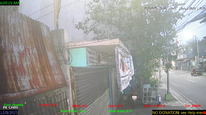
 Pimoh Daimaoh's Personal Weather and Earthquake Monitoring in Caloocan City Philippines
26°C
Baltazar st. Barangay #60 West Gracepark. Caloocan City
Pimoh Daimaoh's Personal Weather and Earthquake Monitoring in Caloocan City Philippines
26°C
Baltazar st. Barangay #60 West Gracepark. Caloocan City 


 rain
rain rain
rain rain
rain


