EL-Nino and La-Nina Monitoring
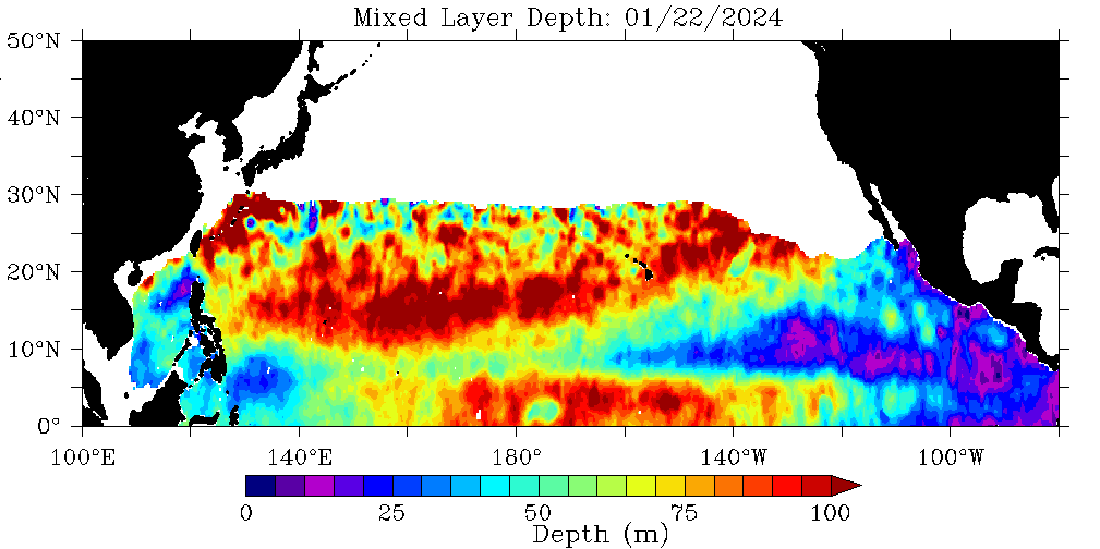
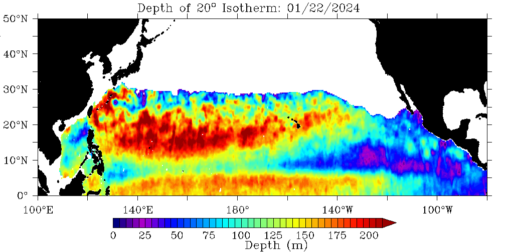
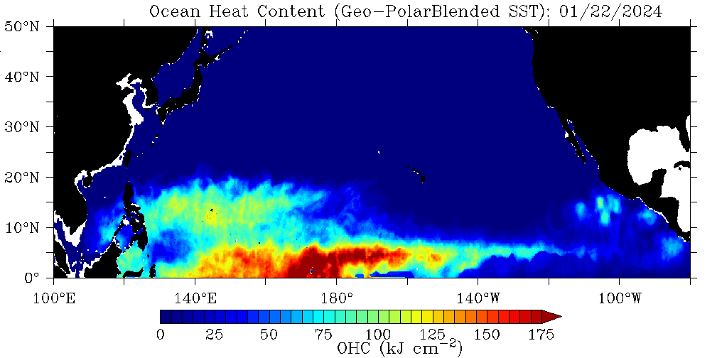
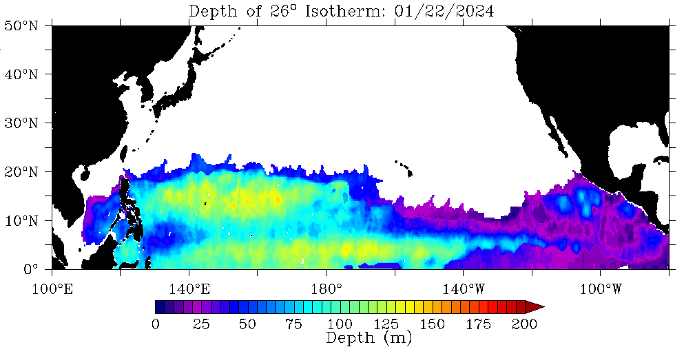
Ocean Heat Content in Relation to Tropical Cyclone Development
(Celsius: |-9.4 | 1.6 | 10 | 24 | 38 | 65.5 | 93.3 |)


What is El-Nino and La-Nina
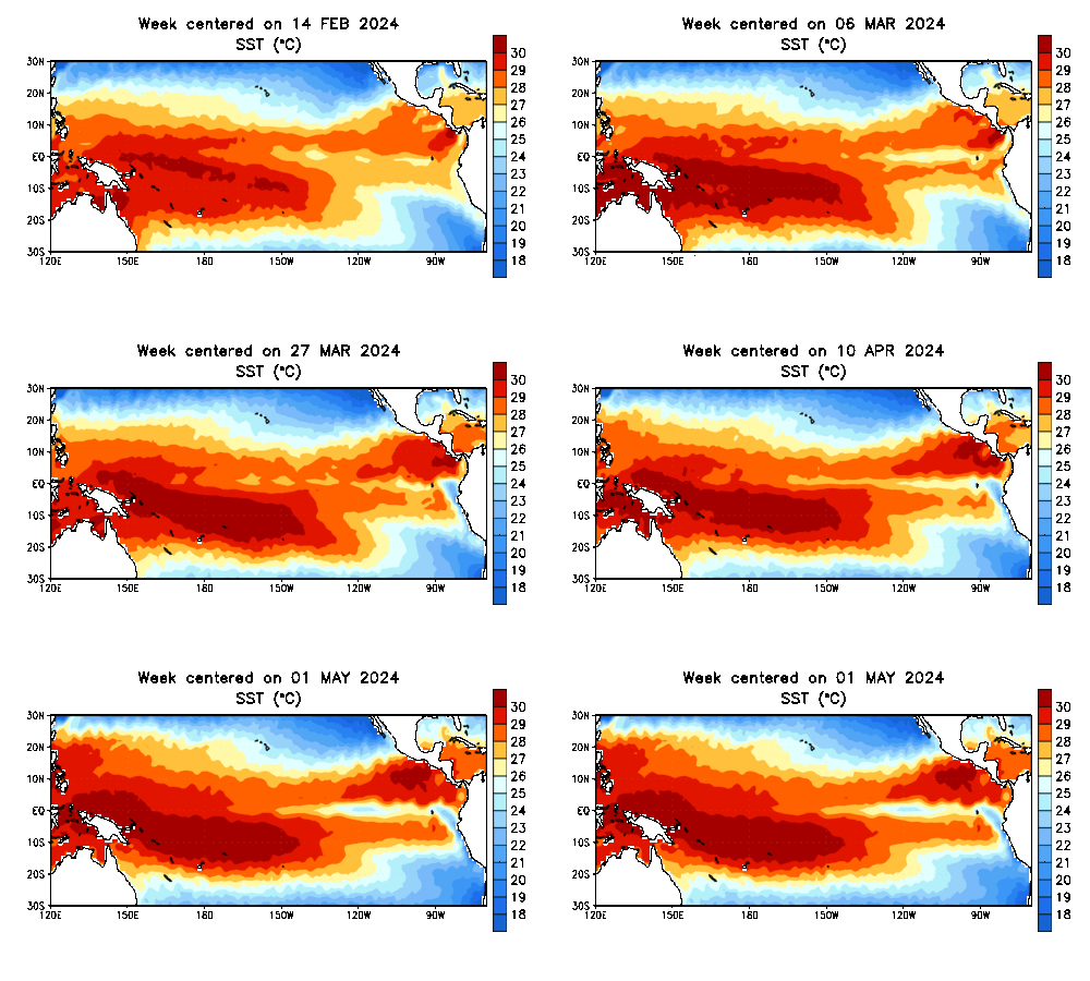
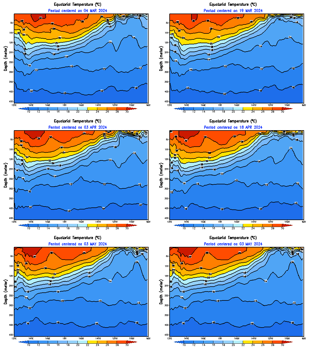
El Niño (/?l 'ni?n.jo?/; Spanish: [el 'ni?o]) is the warm phase of the El NiñoSouthern Oscillation (ENSO) and is associated with a band of warm ocean water that develops in the central and east-central equatorial Pacific (between approximately the International Date Line and 120°W), including the area off the Pacific coast of South America. The ENSO is the cycle of warm and cold sea surface temperature (SST) of the tropical central and eastern Pacific Ocean. El Niño is accompanied by high air pressure in the western Pacific and low air pressure in the eastern Pacific. El Niño phases are known to occur close to four years, however, records demonstrate that the cycles have lasted between two and seven years. During the development of El Niño, rainfall develops between SeptemberNovember.[1] The cool phase of ENSO is La Niña, with SSTs in the eastern Pacific below average, and air pressure high in the eastern Pacific and low in the western Pacific. The ENSO cycle, including both El Niño and La Niña, causes global changes in temperature and rainfall.
La Niña (/l??'ni?nj?/, Spanish pronunciation: [la 'ni?a]) is a coupled ocean-atmosphere phenomenon that is the colder counterpart of El Niño, as part of the broader El NiñoSouthern Oscillation climate pattern. The name La Niña originates from Spanish, meaning "the little girl", analogous to El Niño meaning "the little boy". It has also in the past been called anti-El Niño,[1] and El Viejo (meaning "the old man").[2] During a period of La Niña, the sea surface temperature across the equatorial Eastern Central Pacific Ocean will be lower than normal by 3 to 5°C (5.4 to 9°F). An appearance of La Niña persists for at least five months. It has extensive effects on the weather across the globe, particularly in North America, even affecting the Atlantic and Pacific hurricane seasons.
Images or Data Credits and Provided by: NOAA, RAMMB CIRA, COLA GMU, Wikipedia, livescience.com and NOAA Office of Satellite and Product Operations, ENSO plumes and Images [or Data] credits to: The International Research Institute for Climate and Society, Columbia University Climate School

