Tropical Cyclone Advisories and Forecast

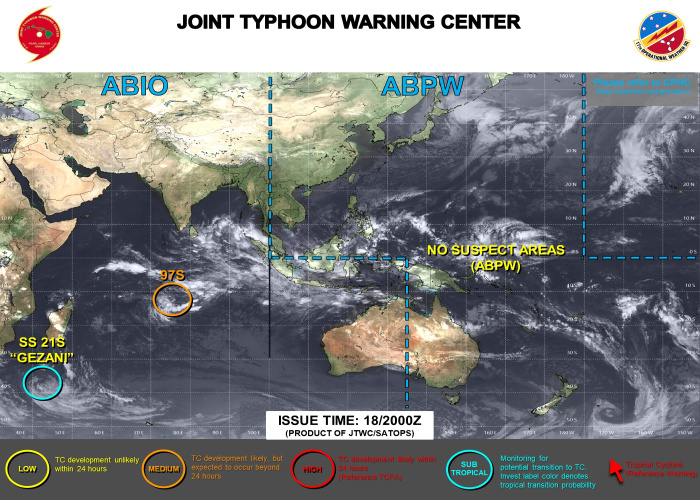
[Computer Generated Synopsis for possible Typhoon Warning Advisories]

Time and Date in UTZ:

310600

-If Typhoon or Invest is Detected on RADAR

-It Will Automatically Generated Below

SOUTH PACIFIC OCEANS/310600ZMAY2023-010600ZJUN2023 /310151ZMAY2023 .

TYPHOON WARNINGS for East Asian Pacific:

(180 TO MALAY PENINSULA):

Summary 1: (1) AT 31MAY23 0000Z, TROPICAL STORM 02W (MAWAR) WAS LOCATED NEAR 21.5N 125.2E, APPROXIMATELY 332 NM SOUTH-SOUTHWEST OF KADENA AB, OKINAWA, JAPANN, AND HAD TRACKED NORTH- NORTHEASTWARD AT 04 KNOTS OVER THE PAST SIX HOURS. MAXIMUM SUSTAINED SURFACE WINDS WERE ESTIMATED AT 60 KNOTS GUSTING TO 75 KNOTS. SEE REF A (WTPN31 PGTW 310300) FOR FURTHER DETAILS. (2) NO OTHER TROPICAL CYCLONES.

Summary 2: NONE.

Summary 3: NONE.

TYPHOON WARNINGS for U.S West Pacific:

(WEST COAST OF SOUTH AMERICA TO 135 EAST):

Summary 1: NONE.

Summary 2: NONE.

Summary 3: NONE.//
Cyclone Forecast

Tropical Cyclone Forecast Track Guidance and Ensembles

Cyclone Track Cyclone Track

JMA TC FORECAST (for next 24 hrs click: HERE for next 48 hrs click: HERE)


TC Track Ensembles for West Pacific for Today. (Ensembles past 24 hrs click: HERE)


TROPICAL CYCLONE Advisory "if active" Courtesy of: Joint Typhoon Warning Center, Tropical Tidbits, Japan Meteorological Agency and Multi-Agency TC tracks credits to: Typhoon2000, Weathernerds.org and Rosentiel school of marine and atmospheric science

BACK